Marcher Castles Way: your questions answered

- Why so many hills
- How do I get there and back, and can I leave my car for a few days?
- How long does it take to ride the route?
- Which kind of bike is best?
- How difficult is it? What’s the terrain like?
- Is there information about accommodation and facilities along the way?
- Can I ride it in either direction?
- Is the route signposted?
Why so many hills?
The reason why the Marches have so many hills is due to the region's unique geology. Volcanic activity millions of years ago created the Wrekin Caer Caradoc and Lawley hills at the eastern edge, while the Stretton fault, formed around 600 million years ago, exposed some of the oldest rocks in the UK. Hills like the Long Mynd were shaped by folded sedimentary rocks, and the Clee Hills by glacial activity. The area's diverse landscape, including valleys like those carved by the River Severn and River Teme, has influenced both the natural scenery and human history, making it a mix of hills, woodlands, and moorlands.
How do I get there and back, and can I leave my car for a few days?
By train
Since Marcher Castles Way is a loop route, starting your journey by train is a great option, as you won’t need to return to the same point to pick up a car. There are train stations at Shrewsbury, Church Stretton, and Ironbridge, giving you multiple starting points to choose from along the route. Shrewsbury is well-connected, with direct services from Birmingham and London, while Church Stretton and Ironbridge also offer convenient regional connections.
Train services in the area can be infrequent, so it’s a good idea to check the timetables and plan ahead. The lines run through some of the most scenic areas of the Welsh borders, offering beautiful views during your journey. It's important to reserve a bike space when booking your ticket, as services typically only have limited bike spaces. If you plan to use Avanti West Coast services to connect with your starting point, note that bike reservations are compulsory on those trains. See our guide to taking your bike on a train for more information on how to book a bike space. For the cheapest tickets, you'll need to book in advance for a specific time, so make sure you allow enough time to finish your ride!
By car
If you prefer to drive, there are several places along the route where you can park for multiple days. In Shrewsbury, long-stay car parks like Abbey Foregate offer affordable multi-day parking options. For those starting in Church Stretton, the Easthope Road car park provides extended stay parking, while Ironbridge has several pay-and-display car parks, such as The Station Yard, where you can leave your vehicle for a few days.
How long does it take to ride the route?
The whole route is 291km / 181 miles long, with 5,207m of ascent.
Keep in mind that the steep terrain can slow you down, so plan your daily distances carefully. We suggest taking around four days to complete the route if you want to enjoy the journey without feeling rushed.
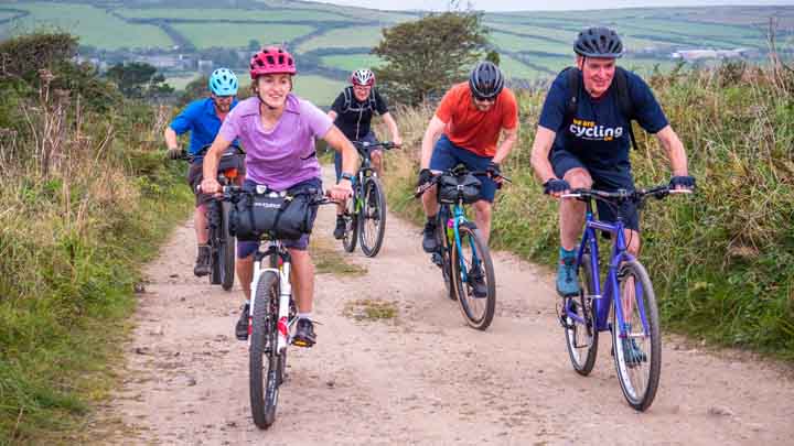
Which kind of bike is best?
We'd recommend a hardtail mountain bike for tackling the Marcher Castles Way. The key advantage of a mountain bike is its wide-range gearing, which will help you conquer the numerous steep climbs you'll encounter along the route.
Additionally, wider tyres provide better traction and more confidence when navigating rough descents and technical sections. A bit of suspension will also make your ride more comfortable over several days, and improve grip on uneven terrain.
While much of the Marcher Castles Way consists of tarmac and gravel tracks, which might tempt you to opt for a gravel bike, it's important to note that you may end up under-geared, particularly when carrying bikepacking bags and camping gear. Some of the descents are loose and rocky, so wider tyres are a big plus. If you do choose a gravel bike, expect to walk certain sections that are more technical, although these stretches tend to be fairly short.
We wouldn't recommend using a road, touring, or hybrid bike, as their limited gearing and narrow tyres will make the ride significantly harder.
If you're considering an electric mountain bike, it will make the climbs easier, but be sure to plan for recharging points, as the hilly terrain of the Marches can quickly drain your battery.
How difficult is it? What’s the terrain like?
The main challenge of the Marcher Castles Way lies in the diverse and often rugged terrain. You'll encounter a mix of smooth roads, fast gravel sections, grassy farm tracks, and some steep, rocky climbs and descents. While we've done our best to keep the route on good roads and gravel surfaces to get you close to summits, be prepared for sections where you'll need to dismount and walk, especially towards the top of the climbs.
Most of the off-road sections have been carefully selected for year-round rideability, but if it’s been wet, expect slower progress through some softer, muddier areas. These varied surfaces not only add to the challenge but also enhance the sense of adventure, offering access to surprisingly remote and wild landscapes right on the edge of the Midlands.
This route is best suited for experienced riders who enjoy a physical challenge. Those seeking a more relaxed or beginner-friendly experience may prefer other routes, such as the Rebellion Way or Cantii Way.
Make sure you're comfortable with your bike setup, and don't hesitate to push if the technical sections become too difficult. A loaded bike, especially on descents, will handle differently, so pack carefully.
Is there information about accommodation and facilities along the way?
When we launch our route guide, there will be information showing the facilities in each town or village close to the route, to help you plan your trip.
Can I ride it in either direction?
Marcher Castles Way is a circular route, so you start at any point of the loop and go in either direction.
That said, the route was planned with a clockwise direction in mind, so that where possible you have steady climbs on slightly smoother surfaces, and fun off-road descents.
Is the route signposted?
Marcher Castles Way is not formally signposted. However, it does intersect with other signposted paths, such as the Jack Mytton Way, and connects with parts of the National Cycle Network. This means that while you may encounter some signage along the route, it’s essential to come prepared with navigation to help you stay on course. You can download the GPX file on the main route page.