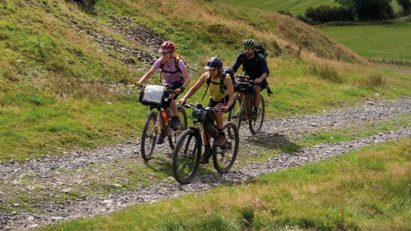
Weekender: Kyle of Sutherland explorer

Route name: Bonar Bridge up and over loop.
Start/finish: Balblair Woods and mountain bike trails, off the A836 just north of Bonar Bridge (OS grid ref: NH60405 92918).
Maps: OS Landranger 21 Dornoch & Alness.
Distance: 35km (22 miles).
Climbing: 594m (1,950ft) Bike type: gravel bike, hardtail mountain bike or e-bike.
Ride level: regular; moderate fitness is required for the climbs.
This ride is on quiet single-track roads, woodland tracks and gravelled forestry fire roads, with views all over the Kyle of Sutherland, which is on the county boundary with Ross-shire.
The area comes within the East Sutherland Bothy Project, a Cycling UK behaviour change initiative which supports people to replace local car journeys with walking or cycling. Free e-bike loans are offered to help achieve this, along with organised led rides from the Kyle of Sutherland Hub.
The Kyle of Sutherland is rich with cycle routes for all abilities of rider, on road and off. It is a gateway to the north and west Highlands, and there are many established cycle events and routes that run through it, such as Land’s End to John o’ Groats, the Pictish Trail and Croick to Ullapool.
It is accessible by train, with four stations in the area. Ardgay is the closest to the Kyle of Sutherland when travelling from the south. Heaven Bikes, in nearby Bonar Bridge, is handy for any spares, repairs or purchases.
Cycle-friendly cafés can be found at Kyle of Sutherland Hub, situated between Ardgay and Bonar Bridge, and at the Falls of Shin (The Salt and Salmon), where you might spot said salmon leaping. There’s also The Pier in Lairg.
Kyle of Sutherland Hub has a bike maintenance and repair station. Part of the route is on Forestry and Land Scotland MTB trails at Balblair. There are plenty of opportunities to ride other marked routes in the area, such as those at Carbisdale Castle.
Halfway round this route you’ll find Loch Migdale, which is ideal for a spot of wild swimming; don’t forget to pack your swimwear in your saddlebag.

1. Shin Railway Viaduct
Starting at Balblair MTB Trails, the route takes you over the Shin Railway Viaduct to Culrain, where you will see your first glimpses of Carbisdale Castle.
An outstanding Scottish example of an early wrought-iron, lattice-girder viaduct, it crosses the Kyle of Sutherland with a single 230ft span. The footbridge was opened in 2000 and offers great views of Carbisdale Castle and the Kyle of Sutherland.
Climbing the steps with your bike has been made easier with the installed cycle channel but you’ll want to use walk-assist if you’re pushing an e-bike.

2. Carbisdale Castle
Built in 1907 in Scottish baronial style for the Duchess of Sutherland after the death of the duke. The marriage was not approved by the family and the will was contested.
The castle’s tower has only three clock faces. The side facing Sutherland is blank as the duchess refused to give her former relatives the time of day.
The route passes Carbisdale Forest up past the castle entrance, joining the forestry road.

3. Loch Carbisdale
A steep climb takes you up to Loch Carbisdale. The route gives you a bird’s eye view over the Kyle of Sutherland before descending back towards Ardgay.
Carbisdale is a natural lochan with a small island, set among an extensive network of forest tracks. There are decommissioned MTB trails, which although no longer maintained are still accessible.
The Battle of Carbisdale (1650) took place here and there is a viewpoint overlooking the site.

4. Kyle of Sutherland Hub
The hub is a voluntary managed social enterprise. Open nine to five, seven days a week, it’s a great café stop for cyclists as it has a bike maintenance station, an e-bike charging point and cycle racks. East Sutherland Bothy Project supports the hub with cycling activities.
After stopping at the hub to refuel, continue up to Migdale and into Ledmore and Migdale Woods.

5. Loch Migdale
The woodland path takes you alongside Loch Migdale. This freshwater loch is surrounded by steep, wooded cliffs, situated within Ledmore and Migdale Woods.
The area is home to Red Squirrels, Pine Martens, deer and, along the shore, otters. If you are very lucky you may even spot a Scottish Wildcat! It is also a popular spot for wild swimming and paddle-boarding.

6. Balblair MTB Trails
Take a quick detour to the water’s edge at the far end of Loch Migdale, for wildlife and maybe a quick dip. Rejoin the track, follow the route back to Migdale and across to Airdens before winding back down to the back of Balblair MTB trails.
These mountain bike trails have options for all abilities. There’s an extensive network of easy forest tracks and blue routes, while more experienced riders can tackle strenuous climbs and descents over rock and slab on the flowing, 17km-long black route. The trails are topped off with stunning views over the Kyle of Sutherland.


