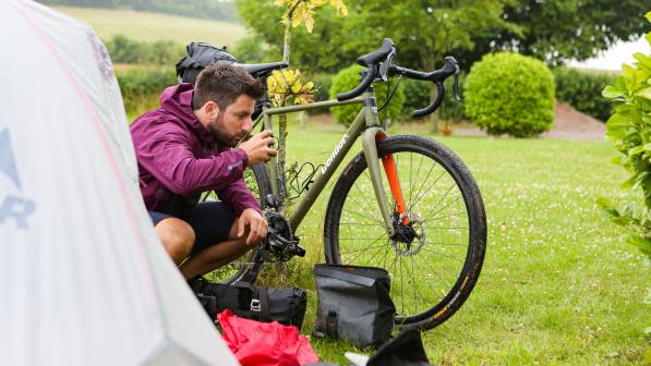
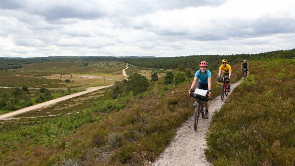
New 350km off-road bike route launched in southern England
King Alfred’s Way, named after the Anglo-Saxon ruler of the ancient kingdom of Wessex, runs for 350km (220 miles) passing iconic locations including World Heritage Sites at Stonehenge and Avebury and Iron Age hill forts at Old Sarum and Barbury Castle, while also riding straight through the heart of quintessential England.
The charity has spent three years working on the route, which connects four of England’s National Trails: North Downs Way, South Downs Way, Ridgeway and Thames Path. The route was developed by upgrading certain sections of footpath to allow cycling, and also includes existing bridleways, byways and quiet country lanes.

Sophie Gordon, Cycling UK’s campaigns officer behind the creation of King Alfred’s Way, said:
“The pandemic has understandably changed the British public’s appetite for foreign travel but with King Alfred’s Way we’re hoping to at least quench its thirst for adventure.
“There’s no need to fly or, for many, even travel far for a challenging trip. King Alfred’s Way is 220 miles of literal ups and downs looping through a quintessential southern England made up of thatched cottages, Iron Age hill forts and stone circles.”
With the route passing within an hour’s journey from home for 17 million people, King Alfred’s Way is the perfect staycation for the more adventurous traveller and promises challenging riding through an ever-changing landscape. With tourism spend from cyclists in the UK £520m per year, it is also a potential avenue of valuable income for rural businesses.
England has 15 National Trails, but only two of them are cyclable from end to end: the Pennine Bridleway and the South Downs Way. Cycling UK’s wider goal is to create a network of long-distance off-road routes across the length and breadth of Great Britain, through amazing places and wild landscapes.
“73 years ago, legislation was passed which led to the creation of our National Parks, Areas of Outstanding Natural Beauty and long-distance trails,” said Sophie Gordon, referring to the Countryside Act 1947. “It’s a godsend for walkers, but for ramblers with bikes not a lot has been done since then in terms of improving access for cycling.
“With King Alfred’s Way we want to show what is possible if we fill those missing links between our National Trails and start making the countryside accessible for everyone – walkers, horse riders and cyclists.”
King Alfred’s Way follows the launch of the 800-mile Great North Trail (Peak District to Cape Wrath or John o’ Groats) in 2019, and the Riders’ Route for the North Downs Way in 2018.
Sophie Gordon added:
“This is a truly fantastic route which will take you past well-known landmarks and along some hidden gems. However, Cycling UK would urge everyone contemplating riding King Alfred’s Way to make sure they are aware of and observe current public health advice related to managing the pandemic before doing so.”
To date, six riders have ridden the complete route.
The route will be available to view online on the Cycling UK website from 00.01 Friday 28 August, where you can find an extensive route guide and downloadable route files (GPX), and also on the Ordnance Survey’s online service (search King Alfred’s Way).
ENDS
Notes to editors
- Cycling UK, the national cycling charity, inspires and helps people to cycle and keep cycling, whatever kind of cycling they do or would like to do. More than a century of experience tells us that cycling is more than useful transport; it makes you feel good, gives you a sense of freedom and creates a better environment for everyone. www.cyclinguk.org
- For more information on King Alfred’s Way, visit: www.cyclinguk.org/kingalfredsway
- Could more access reduce countryside conflict? Cycling UK asks whether the archaic and confusing access laws covering the countryside in England and Wales could be one of the causes behind reports of conflict on the trail.
- What bike is suitable for King Alfred’s Way? Cycling UK asks the question of experienced bike tester Guy Kesteven.
- Images available at: https://www.skyfish.com/p/cyclinguk/1784298
- A guide with Ordnance Survey mapping of the route is available from the Cycling UK website for £12 (not incl. P&P): https://shop.cyclinguk.org/king-alfreds-way-route-guide
- A copy of the online guide, without Ordnance Survey mapping, is available at: https://issuu.com/ctc_cyclists/docs/cycling_uk_kaw_online_artwork
Press contact information
For more information, please contact the national Cycling UK press office. Due to the restrictions caused by the coronavirus outbreak, currently the main press office number (01483 238 315) is not being monitored. If you would like to speak to a member of the press office during working hours (0900-1700) please email [email protected]. Out of hours, call 07786 320 713.


