Why we should design roads for people, not vehicles

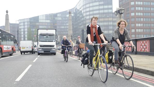
According to the British Social Attitudes Survey, around 62% of people agree that “it is too dangerous for me to cycle on the roads”, almost three times the proportion who disagree (22%).
This broadly aligns with figures from the National Travel Survey (Table NTS 0313), which suggest that 66% of the population in England never cycle, while 24% do so on a weekly or monthly basis.
The negative attitudes to cycling held by so many are hardly surprising: traffic engineering has historically focussed on designing residential and town centre streets to standards more appropriate for trunk roads, thereby encouraging high speeds and the dominance of motor traffic. Inevitably, this has had a detrimental effect on cycling facilities.
Cycling UK believes the Government should instead endorse a more holistic approach to road design, i.e. one that considers the place values of streets, movement of all types of transport, and the health impacts of street design, along the lines of Transport for London’s (TfL) ‘Healthy Streets’ initiative.
What needs to be done?
To unlock the huge health benefits of getting more people to cycle, we believe local authorities must acknowledge and overcome the perceived and actual dangers presented by the existing road network.
This means introducing safer conditions for cycling through:
- Lower speed limits;
- Measures to filter out through movement of motor vehicles from residential and town centre streets;
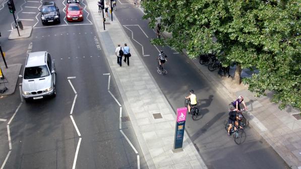
- Dedicated space for cycling on faster or busier main roads; and
- The creation of routes away from the road network.
Local Cycling and Walking Infrastructure Plans and network planning for cycling
The Department for Transport (DfT) is encouraging all local authorities (LAs) in England to produce Local Cycling and Walking Infrastructure Plans (LCWIPs).
LCWIPs represent a new, strategic approach to identifying what improvements need to be made at the local level, ideally over a 10-year period. Forming a vital part of the Government’s strategy to increase the number of trips made on foot or by cycle, their key outputs are:
- a network plan for walking and cycling which identifies preferred routes and core zones for further development;
- a prioritised programme of infrastructure improvements for future investment;
- a report which sets out the underlying analysis carried out and provides a narrative which supports the identified improvements and network.
By taking a strategic approach to improving conditions for cycling and walking, LCWIPs will assist LAs to:
- identify cycling and walking infrastructure improvements for future investment in the short, medium and long term;
- ensure that cycling and walking are considered within both local planning and transport policies and strategies;
- make the case for future funding for walking and cycling infrastructure.
While preparing LCWIPs is not compulsory, LAs who have actively prepared long-term, ambitious plans will be well-placed to make the case for future investment.
Cycling UK is thus urging the Government to ensure that they have the incentives and resources they need to do this, and that the plans produced are robust and comprehensive.
Guidance and tools
Good technical guidance has already been issued to help LAs develop their LCWIPs. This rightly commends the DfT-funded Propensity to Cycle Tool as a means to identify the corridors that are likely to see the biggest increase in cycling, if conditions can be improved.
Also, Transport for London (TfL) has created a similar method for identifying route alignments with the greatest potential for increased cycle use, and has used it to prioritise corridors for cycling improvements.
The Propensity to Cycle Tool, however, benefits from being open-source software, accessible and customisable by LAs or advocacy groups.
In addition, the forthcoming Cycling Infrastructure Prioritisation Toolkit (CyIPT) will provide another mechanism to obtain good data from which to start planning networks and prioritising investment.
Creating robust local cycle networks
The following are important considerations for LAs when creating their local cycle networks:
- Individual schemes will not achieve the same level of growth as a fully implemented network. Hence, the first links are most unlikely to reach their full potential until further links are added over time. It is important to bear this in mind when carrying out initial assessments of how effective the early components of a network are.
- Planned networks should link potential trip destinations and origins, and aim for a mesh density in urban areas of at least 400m, preferably 250m.[1] This ensures that any urban location is no more than 200m away from the network.
- Network planning needs to assess how this planned network intersects with the road network - if users are still exposed to dangerous conditions at any point, the network is severed, and becomes unusable to all but the 22% who are prepared to accept less safe road conditions.
- Particular attention must be paid to junctions, where three-quarters of cycle casualties occur.
The five principles of good cycling design
Good conditions for cycling are those which meet the following five criteria defined in Dutch planning guidance:
- Safe: both objectively and subjectively safe from risk of traffic injury, and from a personal security point of view. This requires physical or temporal separation of different modes, reduced speed differential between users, plus good visibility, lighting, surface quality and maintenance.
- Direct: many users will dismiss a route that is substantially longer than another. Routes must therefore minimise detour, aiming for no more than 20% over the Euclidean distance (straight-line); and keep deviation to the minimum from the most direct route at junctions.
- Coherent: routes should be well-connected with other parts of a dense cycle network; not interrupted or discontinuous, particularly at junctions; and clearly signed.
- Comfortable: surface quality must be good, with the need to stop and start kept to a minimum. As far as possible, routes should be flat and any gradients gentle. Additionally, they need to allow for clearance from other users or vehicles where conflict is possible.
- Attractive: providing pleasant cycling conditions and making cycling more enjoyable, with minimal exposure to air pollution and traffic noise.
For good cycling conditions, routes should satisfy all five of these principles, not just one or two of them.
The three basic types of infrastructure for cycling
Cycling UK believes that infrastructure for cycling falls into three basic criteria:
- Physically protected space for cycling along busier roads;
- Streets designed to filter out motor traffic as much as possible, with low speed limits;
- Routes entirely away from motor traffic, integrated with the wider cycling network.
We discuss these in more detail in a separate article.
LAs, though, are using myriad guidance on designing cycle-friendly infrastructure, which is why we are urging the Government to combine all relevant guidance notes into one ‘Street Design Manual’.
Auditing the network
The DfT’s Route Selection Tool is a useful way of auditing an existing route against the five principles listed above, as well as examining the effect of any planned improvements. This is based on similar processes first adopted in London and Wales.
The London Cycle Design Standards also offers tools to undertake more detailed analysis of junctions and the impact these and busy streets have on how accessible the existing network is for cycling.
Although these tools are extremely useful, we know that local authorities often lack the resources to conduct the required analysis. The DfT’s LCWIP Technical Support programme will certainly help in this respect but, as it is not comprehensive, authorities will still need additional support to plan their networks and prioritise a programme of improvements.
Spatial planning for cycling networks
It is equally important that spatial planning policies place a higher priority on walking and cycling, and impose tests on all new developments to ensure easy, safe access by foot and bike to local services.
While the Manual for Streets is now widely followed when planning networks within new developments, the location and the lack of links to other towns, settlements or destinations beyond the boundary are often a significant barrier to walking and cycling becoming the norm.
This is because new developments are all too often planned in the expectation that their residents, workers or visitors will be travelling principally by car, so they end up with poor connections for non-motorised travel.
We therefore recommend that the LCWIP process is included in the local spatial planning process so that new developments are linked - and contribute - to a good quality cycling and walking network.
Cycle-proofing major projects
Major infrastructure projects must be 'cycle-proofed' to build cycling in from the start. This means that planning authorities - national and local - should ensure that new schemes properly incorporate good design and LCWIPs (see above) into their project plans.
Non-transport projects also offer opportunities to provide cycle infrastructure, e.g. flood prevention schemes, which have received significant funding in recent years.
As far as the major road network is concerned, Highways England’s planning has progressed in recent years to include some provision for cycling, and they have at least issued some good guidance for future schemes.
Problems remain with major projects, however. For instance, significant rail projects such as HS2 are still advancing without catering adequately for walking and cycling. As a result, infrastructure designed for decades of use is building in severance between communities, and will lock many areas into car-dependency.
Resources to retro-fit, not just for new build
Without significantly greater investment, the existing road and street network will never be brought up to the standard required to enable people to cycle in safety and comfort.
Whilst changes to road traffic regulations and design solutions have made a positive difference to walking and cycling conditions over the past few years, there are still several obstacles in the way of more widespread active travel. Chief amongst these is the lack of resources to retro-fit solutions onto the existing road network.
Much of the capital funding available to local authorities in England, either through Local Enterprise Partnerships (i.e. the Local Growth Fund) or through direct government support from other sources (such as the Housing Infrastructure Fund), is designed to facilitate new commercial or residential developments. These developments are often urban extensions or clustered around relief roads, mostly located far from existing services, thereby reducing the opportunities for cycling (and walking).
Schemes which make (and have made) the most positive difference are those focussing on congested corridors in existing dense urban areas, where trip distances are shorter, but cycling (and to some extent walking) has been suppressed in the past by poor infrastructure and heavy traffic.
The introduction of high quality cycling schemes, such as those now seen in London, Manchester and other cycling cities, has shown that substantial increases in cycle use can be generated if the quality of infrastructure is high enough.
Cycling UK would like to see funding streams such as the Transforming Cities Fund rolled out more widely and invested in smaller scale improvements, i.e. particularly walking and cycling corridors on key radials and/or neighbourhood-wide packages of small interventions. To maximise the benefits of schemes like this, it makes sense to accompany them with effective behaviour change programmes.
We also believe that more of the proposed National Road Fund must be allocated to retro-fit cycling schemes onto the proposed Major Road Network (MRN).
- The above recommendations were among over 80 we made in our 'Cycle safety: make it simple' response to the Department for Transport's Cycle Safety Review.
[1] Measuring the ‘mesh density’ of a cycle network helps assess how closely packed it is with parallel routes of similar quality: a tight mesh density gives more route choice than a loose mesh density.


